
Near Real-Time Precipitable Water Vapor (PWV) Mapping from Multi-GNSS
A processing system that turns multi-GNSS ground-station observations into near-real-time maps of atmospheric water vapor over Thailand, to monitor and forecast weather change.
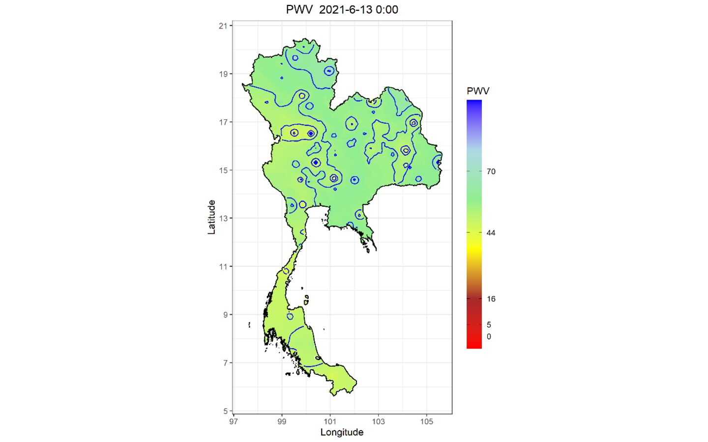
GNSS signals are delayed by water vapor in the atmosphere. The system measures that delay at reference stations across Thailand and converts it into precipitable water vapor (PWV), a key input for rainfall and storm forecasting.
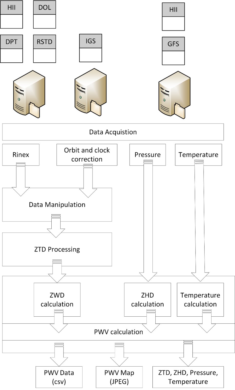
- Data acquisition from HII, Department of Lands, Department of Public Works and Town & Country Planning, RTSD and IGS stations, with GFS pressure and temperature.
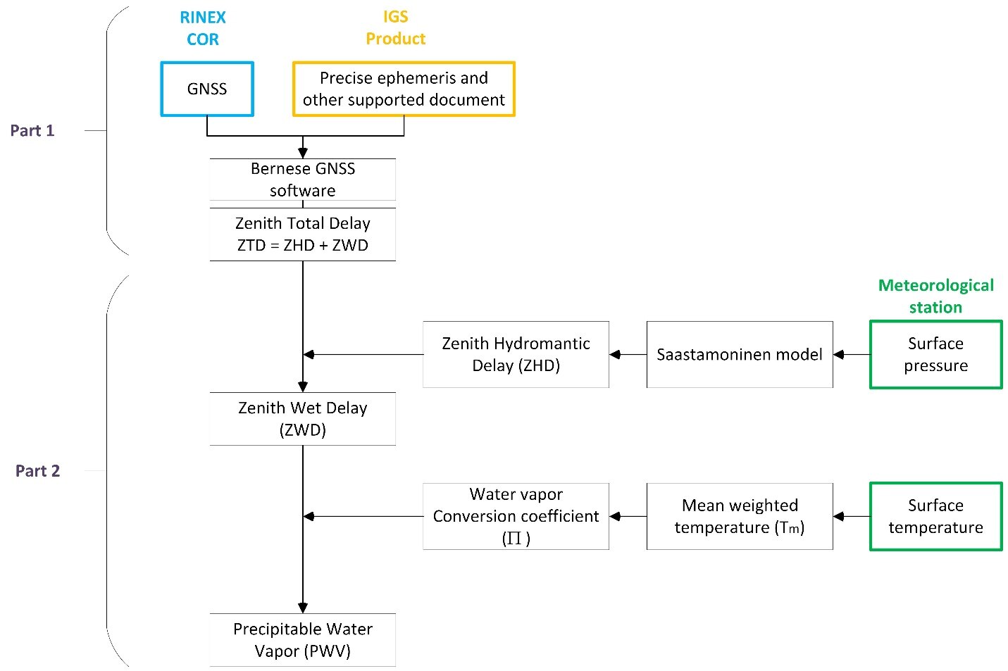
- Zenith total delay processing with Bernese GNSS Software. Hydrostatic delay from the Saastamoinen model, and water-vapor conversion using mean weighted temperature.
- Automated outputs: PWV data (CSV), national PWV maps and ZTD/ZHD products, plus quality assessment against reference observations.
- Consulting, joint operation and staff training at HII.