

Land Subsidence Analysis & Monitoring (InSAR + Machine Learning)
Time-series InSAR measurement of ground subsidence in the Tha Chin Basin and Bangkok’s surrounding provinces, with machine-learning forecasts shown in a web map application.
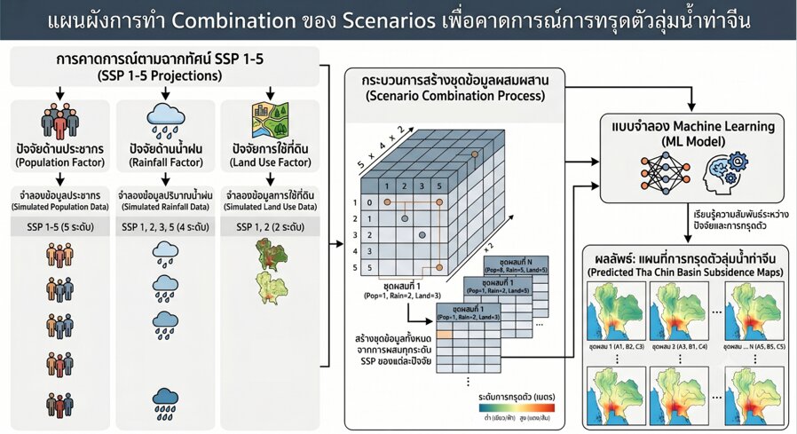
Part of HII’s sustainable flood-management programme. Subsidence rates derived from Sentinel-1 time-series InSAR are analysed against geographic, climate and land-use factors; machine-learning models forecast subsidence under short-, mid- and long-term scenarios. Results are delivered in a web map with charts and administrative-boundary filters.
← All projects